Best Hiking Trail Maps:
Mix And Match To Stay On Track
By Diane Spicer
Hiking trail maps: this topic opens up an entire universe of options for a hiker.
If you're not using maps for your trail time, you're missing out on a lot of fun.
Plus, it's a Hiking Best Practice to know where you are, where you're headed, and what the terrain is like.
Investing a bit of time BEFORE you hit the trail will yield amazing dividends ON the trail - and just might become your new hobby.
- Don't say I didn't warn you. You're gonna need a map annex on the gear locker!
Types of maps for hikers
As a hiker, you can look at maps simply for the type of information they give you, and choose accordingly.
Examples of maps you might need as you travel to a trail head and tackle a hike:
- General reference maps: roads, trails, place names as you get an overview of an area
- Topographical maps: land features, elevation changes, contours which trails pass over and through
- Thematic maps: geology, weather, or other hobbies or passions you have
Paper or digital maps for hiking?
As a hiker, you need to decide whether to carry old school physical paper maps, or to use digital maps downloaded from the internet to your cell phone or GPS device.
Using both on a straightforward day hike might be overkill.
But if you're in unfamiliar territory or on a backpacking trip where the chance of losing the trail is not zero, it's a smart idea to have backup.
- Batteries die.
- Rain leaks into your backpack and soaks everything, or you fall into a stream.
Redundancy for hiking navigation is a smart idea, and shows that you're a prepared outdoors person.
How hikers use maps
There are 3 ways to use maps at home:
- Select and plan your hike: locate the trail head, ideal destination or turn around point, note any private land restrictions, locate water sources and crossings.
- Estimate mileage for pacing and water breaks, set a turn around time or campsite for the night.
- Scout interesting land features and topography: high points for photos, hidden lakes just a short distance from the trail, potential waterfall and canyon areas, old mines, ridges for access to peaks - an open door for adventures!
And I'm guessing you know how you'll be using maps on the trail ;)
Scale and symbols tell the story
Maps are created to share a story with you.
Be sure you speak the mapmaker's language so you can squeeze every last drop of information out of a map.
How to use map scale
The scale of a map will change according to who made it and how it's used, so be sure you're dialed into the numbers.
Scale is the relationship between map distance (two dimensional) and actual distance(three dimensions) on the ground.
- It's expressed as a ratio or fraction.
- Note: The units must be the same for this to work properly, so be sure to understand which units are being used to avoid any nasty surprises on a hike.
Example:
- 1:24,000 means for every one inch of distance on the map you are seeing 24,000 inches on land. Not very useful units, right?
- But it gives you a basis for calculating distances. Read more here.
Using map symbols
Maps have symbolic representations to convey meaning to you before you lay eyes on the land.
Symbols will tell you whether a feature is human built, like roads, buildings, dams, airstrips versus a natural feature: water, hills, plains, valleys, mountains.
For more information on map symbols, go here.
To see topographic map symbols and a key to their meaning, use this free USGS download.
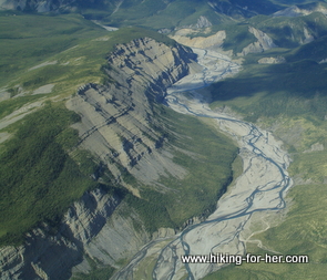 Imagine the way this would look on a map
Let's start with topographical maps
Hikers rely upon "topo" maps for navigation across the features of the land as the trail wanders up and over hills, valleys, ridges, passes, and water crossings.
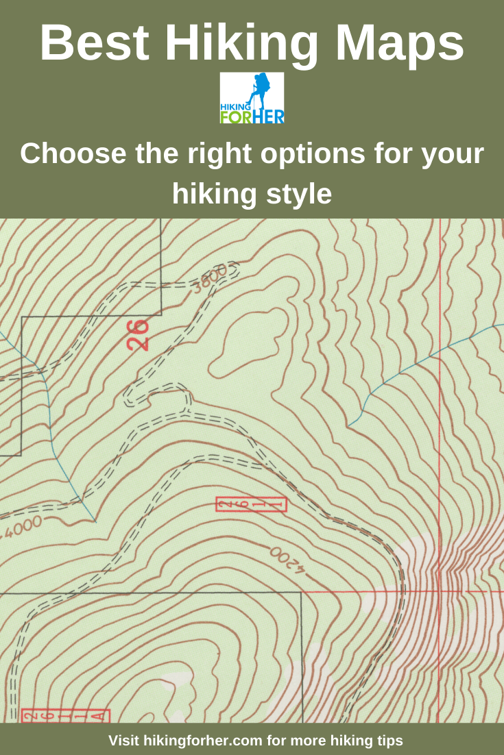
You’ll notice the contour lines right away. They connect points of equal elevation (every point along that line is at the same elevation).
- When contour lines are close together, the terrain is steep. Go back up to the photo at the top and note the spacing of the lines.
A wealth of free topographical
hiking trail maps is available
There are free United States topographical hiking maps, available for instant download and printing thanks to the taxpayers. These provide detailed information on contours and land features.
If you'd rather have someone else do the work to create customized, waterproof topo (a handy shorthand for the long word of topographical) maps, try these folks.
They also have a nice selection of map software, and I'll bet they can recommend something that's a good match for your hiking navigation.
One more nice feature on their website: free online map viewing.
Warning: You can spend a lot of time playing around, creating hiking maps for your next adventure on this site!
- Give yourself at least an hour each time as you discover more and more places to wander.
Paper trail maps
Flat maps, folded maps, downloadable maps...
these little topographical gems deserve a spot in your backpack.
They are indispensable in so many ways:
- finding a surface water source for backpacking trips,
- converting mileage into estimated arrival time at a campsite,
- and my favorite: sitting at a viewpoint and learning the names of the surrounding peaks and drainages.
Here's an example of the wealth of info which is available to you.
Make sure you have a waterproof map case to protect your investment.
U.S. Forest Service maps
Inexpensive U.S. Forest Service maps shows numbered roads, trails, trail heads, and campgrounds.
- Use these when you're scoping out an area for multi-day trips.
- Also use the websites associated with each area to get updated information on road closures, seasonal trail closures, or animal activity that might force a trail closure (unruly mountain goats or bears, for example).
- You can also cross reference the numbered trails with trail reports posted by bloggers or outdoor organizations such as Washington Trails Association.
You'll be amazed at how quickly your map collection grows as your appetite for outdoor time increases! You might have to build a special map repository in your gear locker!
Bureau of Land Management (BLM) maps
The U.S. Department of the Interior (love that name!! I wonder who's in charge of the exterior??) is overseeing (and I quote):
- energy
- fire
- grazing
- planning
- recreation
- national conservation lands
- wild horses and burros
- sage grouse conservation
- and a lot of other stuff including noxious weeds.
They also have loads of maps that you can use to plan some great backcountry travels.
You'll have to poke around a bit to get to the state, and the area within that state, that you're interested in.
But again, prepare to get lost in a wealth of free and low cost information!
State Forest maps
Pick a state.
Put that state's name in front of the words "Department of Natural Resources."
Use your favorite search engine to locate some great info, including maps, about hiking opportunities.
Here's an example: Michigan's Department of Natural Resources.
The home page gives me a wealth of choices, but I go straight to the good stuff by typing "hiking maps" in the search box.
Lo and behold, I find a sweet little map and info on the Iron Belle Trail, which can take your feet from Detroit up into the Upper Peninsula. All the way across the U.P., in fact!
There are lots of other choices on the Michigan DNR site, too, like state parks and mushroom hunting maps.
All sorts of options for a great day outdoors, yours for the clicking.
- It's a great online world, don't you agree?
National Park hiking trail maps
How many national parks are there in the United States?
Ha! Trick question!
If you count everything with a "national" in front of it, there are around 390.
- But not all of these are good for hiking: national monuments and national historic sites, for example, aren't going to give you much mileage.
If you just focus on National Parks, the number drops to 60.
- Want a list of all of them? Here it is!
And here's a great site for locating all kinds of maps for these parks. Just pick the state you're interested in, and drill down.
- Spend some time on this site to explore options you might not have thought about for hiking.
So much information!! So many trails and so little time...sigh.
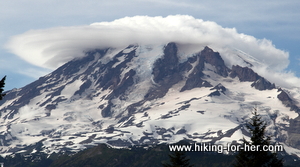 ...Mt. Rainier National Park, for example, wearing a lenticular cloud hat.
Satellite image maps:
birds eye view of hiking trail maps
Why not use the highest level of technology available to plan your next hiking adventure?
Explore Flash Earth now!
National map viewer and
download platform
Since you're geeking around, you might as well try out this site: National Geospacial Program from the U.S. Geological Survey.
It gives you the ability to customize a map, adding or subtracting features such as:
- elevation
- water features
- land cover
- place names
- boundaries
- structures
and lots of other things a hiker might like to find (or avoid).
Apps for hiking trail maps
If you carry your cell phone with you when you hike, why not load it up with an app that lets you navigate, record your location and progress, and share hikes with other hikers?
Apps to try:
- MotionX GPS
- Hiking Project from REI Co-op
- GaiaGPS
- CalTopo
A few tips for using your phone to navigate
If you decide to use your cell phone with an app as a navigation tool on your hike, maximize your battery life.
Start with a fully charged unit, and then:
- Use the airplane mode setting.
- Dim the screen and use other power saving options for your particular model.
- Shut off background apps that churn through electrons needlessly.
- Be strict about using the phone only when necessary for navigation.
- Be mindful of battery life in relation to ambient temperature; extremes will eat into your time.
Hiking trail maps = big fun!
And a few skills
If you stick to well marked trails and never consider carrying hiking trail maps, you're missing out on a lot of fun.
You might have hiked within a few hundred yards of a great little lake, or a waterfall you could have had all to yourself for the afternoon.
Maybe there's an abandoned mine site you could explore, or the ruins of a homestead.
And wouldn't it be cool to know ahead of time where you could climb a hill to get a better view?
Hiking pedometers -
make your steps count
Now that you know how many miles you're going to cover, why not verify it with a pedometer?
I review a simple, lightweight device here that does double duty as a fitness tracker: calories, food, sleep, motivation.
Or look through your options available at REI Co-op: Fitbit, Garmin, Suunto and more.
The reason I recommend using a separate, reliable device?
- It teaches you a sense of what mileage feels like, so you can begin to estimate how tired (or not) you'll be at the end of a hike.
- You can also use that kinesthetic "feel" for mileage to estimate how far you've gone at any particular point during a hike. Very useful for pacing!
It makes the symbols on a piece of paper (i.e. a hiking map) come alive in a new dimension.
Hiking trail maps -
start your collection today!
The best hiking maps are easy to use, portable, weather resistant, and fold up quickly!
Don't leave home without one.
Start your hunt for the best hiking trail maps right now, using my tips.
Just think of the places you'll go (to channel a bit of Dr. Seuss, who would have made an excellent hiker).
And a map annex in your dwelling is a really cool notch in your hiking tool belt.
Trust me...you're gonna love being a map aficionado.
Home page > Hiking Resources >
Hiking Trail Maps
|
I get emails all the time about what I wear, eat, carry and love to use on the trail. That's
why I provide affiliate links to you: the best gear that I use myself and have seen used by other hikers is instantly
available for your consideration, and the gear company sends a few
pennies per dollar to this reader-supported hiking website. There is no added cost to you! Everyone ends up a winner: Great gear for you, strong gear companies, and more free hiking tips for everyone. Thanks very much for your support. It's warmly and sincerely appreciated. It also helps send these hiking tips to all your virtual trail buddies around the globe. |
 |
